Hello Everyone. Today, I want to share with you one of the tools we used in our search for land and I will do this in two parts. In today’s post, I will do an introduction to GIS and how you can potentially locate the tool for your area. In the second part, I will talk more about how we used the tool in hopes that it can help you on your journey as well. Also, I will try my best not to geek out. I am in the software industry and by nature sometimes that’s what I do. The cool thing is that being a little computer savvy can help in your land search as well.
See, when you have made the decision to purchase property, there are plenty of things to consider and you will want to use all the tools you have at your disposal. After all, buying land is not something you do on a whim like you would purchasing candy or buying a pair of shoes. It requires quite a bit of forethought on your part, which is why it is critical to know what you want and why you want it. For example, your decision to purchase a raw tract of land for hunting may be drastically different than your decision to purchase one for residential and farming purposes.
What Is It?
When we first started our search, we used resources such as Realtor.com & Zillow.com, Google Maps, as well as special land inventory websites such as Landwatch.com. These websites helped us to locate property in our desired areas. Once we located potential properties then we wanted to know more about them prior to engaging a real estate agent. This is where GIS comes into play. Now, just what in the world is GIS? Well, according to the University of Wisconsin, it is:
A geographic information system (GIS) is a system designed to capture, store, manipulate, analyze, manage, and present all types of geographical data. The key word to this technology is Geography – this means that some portion of the data is spatial. In other words, data that is in some way referenced to locations on the earth. 1
In a nutshell, GIS allows you to view geographical information about land such as elevations, soil types, waterways, railroads, zoning, land parcel boundaries, acreage, flood zones – and that is only scratching the surface of what you can do with GIS.
Where to Find GIS?
We are in North Carolina and just like tax information is public knowledge, so is all property information. One way to reveal this information is to make it available via each county’s GIS website. Yep, there are free tools that you can use online to explore property information. Below is a list of county GIS websites that we used for Wake and surrounding counties in our area:
- Franklin County – http://maps2.roktech.net/Franklin_GM4/
- Orange County – https://gis.orangecountync.gov:8443/orangencgis/default.htm
- Johnston County – https://mapclick.johnstonnc.com/mapclick/MapClick4/
- Wake County – https://maps.raleighnc.gov/iMAPS/
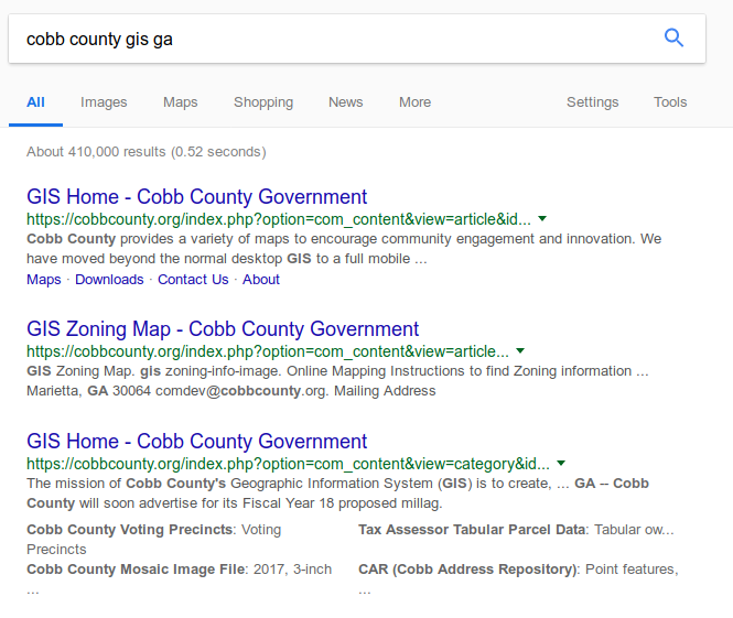
Now, what about your state and county? You’ll have to do some digging but it is probably out there somewhere. I would google something in the format of,
<COUNTY> county gis <STATE>
where you replace <COUNTY> with the county in which you are looking for land and replace <STATE> with the two-letter abbreviation for the state. For example, if I wanted to find the GIS website for Cobb County Georgia, then when I search in the suggested format, I will get the following results:

Unfortunately, at least in NC, just as each county’s website is different, so is each GIS site. This means that once you learn the way one county GIS website works, you have to figure out how it works in another county. The cool thing is that once you understand how you want to use it, you’ll quickly learn how to translate the concepts to each county’s tool.
I encourage you to get out there and find the GIS website for your country and state, then play around with it. Once you find your desired website, you may be taken to the county page where you have to read and find the tool. However, it should give you the information needed to begin using it for property information. The learning curve may be steep for some and none for others, but keep using it and it will start to make sense to you. Let me know what you find as you include this tool in your property search.
In it Part 2 of using GIS as a tool in your property search, we will discuss how we used the tool in our decision making process. Click here to read Part 2.
References: